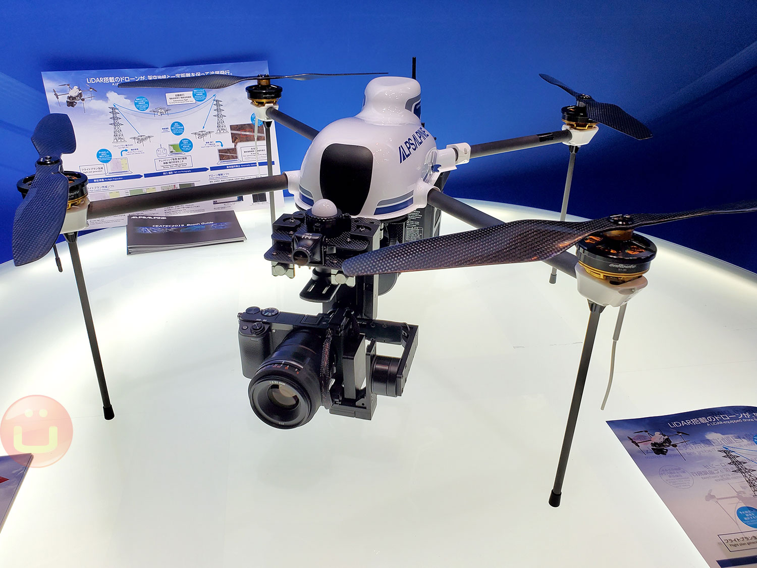
ALPS, known for its in-car electronics components has put together a Done system that can autonomously inspect powerline infrastructure.
The drone has highly precise and sensitive sensors, including a Lidar, which is a laser-based radar that provides 3D awareness of what’s around the drone. As an upgrade, ALPS is working on adapting an RF (radio-frequency) positioning system that has a 30cm (11-inch) precision instead of the normal 16 feet precision of civilian GPS systems.
Power companies like PG&E have tested drone inspections since 2016, and it would typically be used for difficult terrain where it is dangerous and time-consuming (expensive) for human personnel to go. An inspection requires a drone pilot and a supporting team.

But what if all of this could be automated further, to the point that routine inspections could be done very regularly without much setup and human intervention?
ALPS proposes to automatically create flight plans along the powerline, which makes a lot of sense since the powerline positioning isn’t likely to change anytime soon. Once the rough path is set, the drone’s Lidar and autopilot can deal with local obstacles, thanks to collision detection and other automated features that are increasingly incorporated in drones.
After the automatic take-off (and landing), the drone transmits real-time video and flight data, and a human operator can take over at any time, if there’s something of interest that would justify a deviation from the scheduled flight. Operators have a map view, but also a live “pilot” view from the drone’s camera.

The demo drone had a camera mount with a Sony 4K camera (you can change it), that can capture a video feed far superior in quality to consumer-level drones, which makes it possible to spot small damage during video recording that can be analyzed automatically by an artificial intelligence algorithm (AI) tailored to this industry. In this instance, the AI is provided by Toshiba Digital Solutions Corporation.
The flight plan creation software is extremely complex and is at the core of the expected productivity gains. It also takes into account local drone flight regulations that could be changed and dispatched to all users as changes happen.
Traditionally, power utilities have done this type of inspections by having robots travel along powerlines. Sometimes these robots are equipped with Lidar sensors as well. However, there are drawbacks to using such robots hanging from powerlines. First, the robot can induce some cable sagging, which slightly changes the condition of the powerline. Secondly, if the powerline is down, the robot can no longer do its job.
Flying drones are much better since they are completely independent of the powerline, and they can fly to a different vantage point. Finally, they can come and go without having humans suspend them to the cable to start with.
As human intervention diminishes, it is possible to inspect more, more often and at a lower price, to focus the personnel effort on actually fixing the infrastructure, rather than searching for problems to solve, thus better utilizing the limited resources available.
ALPS often puts together complete solutions that are based on multiple of its sensors. The company markets both individual components but also fully integrated systems to make it easier for potential customers to adopt or upgrade new products.
Filed in . Read more about Alps, CEATEC, CEATEC 2019, Drones, Powerline and Safety.